Mostrar el registro sencillo del ítem
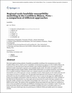
Regional-scale landslide susceptibility modelling in the Cordillera Blanca, Peru - a comparison of different approaches
| dc.contributor.author | Bueechi, E. | |
| dc.contributor.author | Frey, Holger | |
| dc.contributor.author | Huggel, Christian | |
| dc.contributor.author | Klimes, Jan | |
| dc.contributor.author | Strozzi, Tazio | |
| dc.contributor.author | Cochachin Rapre, Alejo | |
| dc.date.accessioned | 2018-12-17T21:22:19Z | |
| dc.date.available | 2018-12-17T21:22:19Z | |
| dc.date.issued | 2018-10 | |
| dc.identifier.citation | Bueechi, E., Klimes, J., Frey, H. et al. (2018) Regional-scale landslide susceptibility modelling in the Cordillera Blanca, Peru - a comparison of different approaches. Landslides, 1-13. doi: https://doi.org/10.1007/s10346-018-1090-1 | es_PE |
| dc.identifier.issn | ISSN: 1612-510X (Print) 1612-5118 (Online) | es_PE |
| dc.identifier.uri | https://hdl.handle.net/20.500.12543/3141 | |
| dc.description | Filiación institucional de autor: Alejo Cochachín Rapre / Autoridad Nacional del Agua - Unidad de Glaciología y Recursos Hídricos (ANA-UGRH), Huaraz, Peru | es_PE |
| dc.description | Original abstract: This study applied existing methods of landslide susceptibility modelling of the mountainous area of the Cordillera Blanca (Peru), which is prone to landslides. In heterogeneous regions as in the Cordillera Blanca, the performance of a physically based approach Stability Index Mapping (SINMAP) was compared to empirical statistical models using logistic regression and a landslide density model. All models were applied to three different digital elevation models (DEMs): ASTER GDEM, SRTM (both 30-m spatial resolution), and TanDEM-X (12-m spatial resolution). Obtained results were evaluated using the area under the receiver operating characteristic curve (AUC) approach, once for a landslide inventory which extends over the whole study area and once using an inventory of a smaller area. The physically based approach (AUCs between 0.567 and 0.625) performed worse than the statistical models (AUCs from 0.672 to 0.759) over the large area. Additionally, all models received higher performances within the small area. This coincided with differences of the variability of the DEM-derived characteristics (e.g. slope angle and curvature) from the small to the large evaluation area. Using the smaller evaluation area, all models received higher AUC values (0.743– 0.799), and the impact of the DEMs was less visible. The analysis of the susceptibility showed that mainly the same slopes are considered as most or least susceptible by all models, but SINMAP is classifying larger areas as unstable or stable. Overall, this study showed that regional-scale landslide susceptibility modelling can lead to reasonable results even in regions with scarce model input data, but performances of different DEMs and models need to be evaluated carefully. | es_PE |
| dc.description | Artículo en período de embargo | es_PE |
| dc.description.abstract | Aplica los métodos existentes en relación al modelo de susceptibilidad al deslizamiento de tierras montañosas de la Cordillera Blanca (Perú), zona propensa a los deslizamientos de tierra. A la vez, compara el funcionamiento del Mapeo del Índice de Estabilidad (SINMAP) basado en el enfoque físico con modelos estadísticos empíricos utilizando regresión logística y un modelo de densidad de deslizamientos. Menciona que todos los modelos se aplicaron a tres modelos diferentes de elevación digital (DEMs): ASTER GDEM, SRTM (ambos con resolución espacial de 30 m) y TanDEM-X (resolución espacial de 12 m). En general, este estudio demostró que el modelo de susceptibilidad al deslizamiento de tierras montañosas a escala regional puede conducir a resultados razonables incluso en regiones con pocos datos de entrada de modelos, sin embargo los rendimientos de diferentes DEMs y modelos deben evaluarse cuidadosamente. | es_PE |
| dc.format | application/pdf | es_PE |
| dc.language.iso | eng | es_PE |
| dc.publisher | Springer Berlin Heidelberg | es_PE |
| dc.relation.ispartofseries | Landslides, October 2018, pp 1–13 | es_PE |
| dc.relation.uri | https://doi.org/10.1007/s10346-018-1090-1 | |
| dc.rights | info:eu-repo/semantics/closedAccess | es_PE |
| dc.rights | Attribution-NonCommercial-NoDerivatives 4.0 International | * |
| dc.rights.uri | https://creativecommons.org/licenses/by-nc-nd/4.0/ | * |
| dc.source | Autoridad Nacional del Agua | es_PE |
| dc.source | Repositorio institucional - ANA | es_PE |
| dc.subject | Comportamiento de eventos extremos de origen glaciar y climático | es_PE |
| dc.subject | Adaptación al cambio climático y eventos extremos | es_PE |
| dc.subject | Monitoreo de lagunas y glaciares | es_PE |
| dc.title | Regional-scale landslide susceptibility modelling in the Cordillera Blanca, Peru - a comparison of different approaches | es_PE |
| dc.type | info:eu-repo/semantics/article | es_PE |
| dc.identifier.doi | https://doi.org/10.1007/s10346-018-1090-1 | es_PE |
| dc.coverage.basin | Cuenca Santa |


