Mostrar el registro sencillo del ítem
Reconstruction of the 1941 GLOF process chain at Lake Palcacocha (Cordillera Blanca, Peru)
| dc.contributor.author | Mergili, Martin | |
| dc.contributor.author | Pudasaini, Shiva P. | |
| dc.contributor.author | Emmer, Adam | |
| dc.contributor.author | Fischer, Jan-Thomas | |
| dc.contributor.author | Cochachin Rapre, Alejo | |
| dc.contributor.author | Frey, Holger | |
| dc.date.accessioned | 2020-02-29T21:56:11Z | |
| dc.date.available | 2020-02-29T21:56:11Z | |
| dc.date.issued | 2020-01 | |
| dc.identifier.citation | Mergili, M., Pudasaini, S. P., Emmer, A. et al.(2020) Reconstruction of the 1941 GLOF process chain at Lake Palcacocha (Cordillera Blanca, Peru). Hydrology and Earth System Sciences, 24, 93-114. doi: https://doi.org/10.5194/hess-24-93-2020 | es_PE |
| dc.identifier.issn | ISSN: 1027-5606, ESSN: 1607-7938 | es_PE |
| dc.identifier.uri | https://hdl.handle.net/20.500.12543/4371 | |
| dc.description | Filiación institucional de autor: Alejo Cochachín Rapre /Autoridad Nacional del Agua - Unidad de Glaciología y Recursos Hídricos (ANA-UGRH), Huaraz, Peru | es_PE |
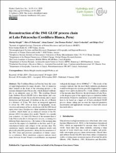
| dc.description | Original abstract: The Cordillera Blanca in Peru has been the scene of rapid deglaciation for many decades. One of numerous lakes formed in the front of the retreating glaciers is the moraine-dammed Lake Palcacocha, which drained suddenly due to an unknown cause in 1941. The resulting Glacial Lake Outburst Flood (GLOF) led to dam failure and complete drainage of Lake Jircacocha downstream, and to major destruction and thousands of fatalities in the city of Huaráz at a distance of 23 km. We chose an integrated approach to revisit the 1941 event in terms of topographic reconstruction and numerical back-calculation with the GIS-based open-source mass flow/process chain simulation framework r.avaflow, which builds on an enhanced version of the Pudasaini (2012) two-phase flow model. Thereby we consider four scenarios: (A) and (AX) breach of the moraine dam of Lake Palcacocha due to retrogressive erosion, assuming two different fluid characteristics; (B) failure of the moraine dam caused by the impact of a landslide on the lake; and (C) geomechanical failure and collapse of the moraine dam. The simulations largely yield empirically adequate results with physically plausible parameters, taking the documentation of the 1941 event and previous calculations of future scenarios as reference. Most simulation scenarios indicate travel times between 36 and 70 min to reach Huaráz, accompanied with peak discharges above 10 000 m3 s−1. The results of the scenarios indicate that the most likely initiation mechanism would be retrogressive erosion, possibly triggered by a minor impact wave and/or facilitated by a weak stability condition of the moraine dam. However, the involvement of Lake Jircacocha disguises part of the signal of process initiation farther downstream. Predictive simulations of possible future events have to be based on a larger set of back-calculated GLOF process chains, taking into account the expected parameter uncertainties and appropriate strategies to deal with critical threshold effects. | es_PE |
| dc.description | Artículo en acceso abierto | es_PE |
| dc.description.abstract | Menciona que la Cordillera Blanca en Perú ha sido el escenario de deglaciación rápida durante muchas décadas, siendo Palcacocha uno de los lagos formados ante este fenómeno, el cual en 1941 drenó repentinamente debido a una causa desconocida; esta inundación por desborde violento de lago glaciar (en inglés, Glacier lake outburst flood o GLOF) condujo a la falla de la presa y al drenaje completo del Lago Jircacocha aguas abajo, ocasionando muerte y destrucción en la ciudad de Huaraz. Refiere que con fines de estudio, se seleccionó un enfoque integrado para volver a visitar el evento de 1941 en términos de reconstrucción topográfica y cálculo posterior numérico considerando escenarios de simulación para determinar las causas y poder predecir eventos futuros. | es_PE |
| dc.format | application/pdf | es_PE |
| dc.language.iso | eng | es_PE |
| dc.publisher | EGU | es_PE |
| dc.relation.ispartofseries | Hydrology and Earth System Sciences, January 2020, Volume 24, pp 93-114 | es_PE |
| dc.relation.uri | https://www.hydrol-earth-syst-sci.net/24/93/2020/ | |
| dc.rights | info:eu-repo/semantics/openAccess | es_PE |
| dc.rights | Attribution-NonCommercial-NoDerivatives 4.0 International | es_PE |
| dc.rights.uri | https://creativecommons.org/licenses/by-nc-nd/4.0/ | * |
| dc.source | Autoridad Nacional del Agua | es_PE |
| dc.source | Repositorio institucional - ANA | es_PE |
| dc.subject | Comportamiento de eventos extremos de origen glaciar y climático | es_PE |
| dc.subject | Gestión de riesgos de desastres en recursos hídricos | es_PE |
| dc.subject | Monitoreo de lagunas y glaciares | es_PE |
| dc.title | Reconstruction of the 1941 GLOF process chain at Lake Palcacocha (Cordillera Blanca, Peru) | es_PE |
| dc.type | info:eu-repo/semantics/article | es_PE |
| dc.identifier.doi | https://doi.org/10.5194/hess-24-93-2020 | es_PE |
| dc.coverage.basin | Cuenca Santa |


